Gunung Gading National Park features a comprehensive network of color-coded trails that cater to hikers of all fitness levels, from casual nature walkers to serious trekkers. The park’s trail system encompasses approximately 3,800 meters of ascending terrain through pristine dipterocarp rainforest, with routes ranging from leisurely 20-minute plankwalks to epic full-day expeditions. All trails begin from the Park Headquarters (elevation 39 meters), which sits near sea level, creating significant elevation challenges for longer routes.
1. Rafflesia Trail (Plankwalk): 600 meters
Difficulty: Easy
Duration: 20-30 minutes
Elevation Gain: Minimal
Highlights and Experience
The Rafflesia Trail represents the most accessible introduction to Gunung Gading’s primary claim to fame. This specialized route features an elevated plankwalk system constructed specifically to protect the delicate Rafflesia tuan-mudae plants and their host Tetrastigma vines from trampling damage. Rather than hiking through challenging terrain, visitors walk along wooden boardwalks winding through forest sections where Rafflesia flowers are known to bloom.
The trail’s primary advantage is accessibility—families with children and visitors with limited mobility can reach Rafflesia habitat without strenuous physical effort. Throughout the walk, visitors observe young Rafflesia buds in various developmental stages embedded in the forest floor, ranging from newly-emergent swellings to cabbage-sized pre-bloom formations. Even without active blooms, examining the parasitic plant’s growth cycle within the Tetrastigma host vine provides valuable botanical education.
Park guides available for hire (approximately RM 30) significantly enhance the experience by explaining the Rafflesia’s parasitic lifestyle, pollination mechanisms, and the reasons behind its extreme rarity. The Interpretation Centre at Park HQ provides additional context about the plant’s ecology before or after the plankwalk visit.
2. Waterfall 1 Trail: 600 meters
Difficulty: Easy
Duration: 30-45 minutes
Elevation Gain: Minimal
Highlights and Experience
This foundational waterfall trail introduces visitors to Gunung Gading’s water features through well-maintained pathways marked with clear jungle signage. The route descends through secondary rainforest to reach a refreshing cascade and deep jungle pool suitable for swimming. The waterfall’s relatively pristine condition, clear cold water (approximately 15°C), and minimal difficulty make it ideal for families and those seeking a quick natural reward without substantial physical exertion.
The pool at Waterfall 1 offers genuine relief from tropical heat, and the surrounding rainforest canopy creates an intimate setting for appreciating the forest’s biodiversity. Early morning visits typically reveal bird activity and occasional mammal sightings in the surrounding trees.
3. Reservoir Trail: 700 meters
Difficulty: Easy to Moderate
Duration: 40 minutes
Elevation Gain: Modest
Highlights and Experience
This less-crowded trail extends beyond the waterfall system to reach a constructed water storage reservoir, offering an alternative to the standard waterfall routes. The Reservoir Trail provides a more serene experience than busier routes, particularly for visitors seeking quieter forest immersion without the crowds. The destination offers viewpoints overlooking the water facility and surrounding rainforest, making it a worthwhile diversion for photographers seeking different perspectives.
4. Batu Apek Trail: 900 meters
Difficulty: Moderate
Duration: 1-1.5 hours
Elevation Gain: Significant (approximately 200-300 meters)
Highlights and Experience
Batu Apek, meaning “big rock,” marks a geographical feature and trail junction that connects multiple park routes. This moderate trail segment requires noticeably greater effort than the easy waterfall walks, ascending through increasingly steep terrain toward higher elevation viewpoints and trail intersections. The name references a prominent boulder formation encountered along the trail’s upper sections.
Reaching Batu Apek represents a natural progression for hikers wanting more challenge than Waterfall 1 but hesitating before committing to the full summit route. The trail provides intermediate views of surrounding forest and elevation gain without the complete day-long commitment of higher peaks.
5. Waterfall 3 Trail: 1,100 meters
Difficulty: Moderate
Duration: 1-1.5 hours one way
Elevation Gain: Approximately 300-400 meters
Highlights and Experience
Waterfall 3 consistently emerges as visitors’ favorite waterfall destination within the park. The moderately challenging trail ascends through dense jungle, passing through Batu Apek terrain and increasingly steep forest sections before descending to a spectacular multi-tiered cascade and pristine swimming pool.
The waterfall’s exceptional beauty justifies the intermediate physical demands. The location’s cultural significance derives from local mythology claiming three princesses once visited the site and planted bamboo for good fortune. Numerous visitor reviews specifically cite Waterfall 3 as superior to other cascades in the park, making it an essential destination for waterfall enthusiasts. The cold water and surrounding forest canopy create an ideal environment for swimming, relaxation, and wildlife observation. Spending 1-2 hours at this location is common, with many hikers utilizing the time for refreshing swims and resting.
6. Waterfall 7 Trail: 1,650 meters
Difficulty: Moderate to Challenging
Duration: 1.5-2 hours one way (3-4 hours round trip)
Elevation Gain: Approximately 400-500 meters
Highlights and Experience
The most ambitious waterfall destination, Waterfall 7 represents a significant step up in physical demand and rewards intrepid hikers with the park’s final major cascade in the waterfall sequence. This trail passes through all previous waterfall locations (Waterfalls 1 and 3) while continuing upstream along the river system to reach the seventh cascade.
Waterfall 7 distinguishes itself through dramatic setting and environmental features. The cascade sits surrounded by ancient fig trees, creating a prehistoric rainforest atmosphere, and drops into a crystal-clear pool with rocky valley surroundings. The extended journey through multiple waterfall ecosystems exposes hikers to diverse habitat types—from lower forest near sea level to mid-elevation montane conditions.
The full Waterfall 7 experience typically consumes 3-4 hours from Park HQ (including time for swimming and rest at the site). Some hikers continue to this location after hiking to the Gunung Gading summit, creating extended 5-6 hour adventures. The combination of physical challenge, natural beauty, and extended immersion in primary rainforest makes Waterfall 7 a worthwhile destination for reasonably fit hikers.
7. Gunung Gading Summit Trail: 3,800 meters (complete ascent)
Difficulty: Moderate to Challenging
Duration: 5-6 hours round trip (3 hours to summit for fit hikers, variable descent time)
Elevation Gain: Approximately 850-860 meters (ascent from sea level to 892 meters elevation)
Highlights and Experience
The flagship trek to Gunung Gading’s eastern peak (889 meters elevation) or the adjacent Gunung Perigi summit (892 meters, the range’s true highest point) represents the park’s most ambitious single-day hike. The three-kilometer trail winds through primary rainforest, ascending progressively through multiple terrain types from lowland forest near sea level to hill forest approaching the summit.
Trail Character and Progression: The ascent follows a well-marked forest path that generally winds through smaller valleys and ridges rather than ascending directly. A small river runs through much of the valley, providing constant sound and occasionally requiring water crossings. The trail passes through diverse habitat zones, with forest composition changing noticeably at higher elevations. Intermediate stopping points include Batu Apek (approximately 900 meters elevation), Lintang Trails (approximately 900 meters), and a viewpoint at approximately 1,200 meters elevation offering panoramic rainforest perspectives.
Summit Views and War Remnants: Upon reaching the 892-meter summit, hikers gain panoramic views across the rainforest canopy with clear-weather sightings of the South China Sea, distant Lundu town, and the international border area with Indonesia. The summit area contains historical remnants from World War II (British military base) and the 1960s Communist insurgency, adding historical significance to the geographical achievement. These war relics represent fascinating reminders of Sarawak’s recent history embedded within the rainforest landscape.
Return to Base: The descent requires equal or greater time than ascent due to knee-stress and slippery conditions on steep downhill sections. Many hikers report 2.5-3 hours for descent versus 2-2.5 hours for ascent. Total round-trip time of 5-6 hours is realistic for moderately fit hikers maintaining steady pace with minimal breaks.
Extended Batu Berkubu Route: Extremely ambitious hikers can continue beyond Gunung Gading’s summit to reach Batu Berkubu, extending the complete hike to 7,400 meters total distance and requiring a full-day to multi-day expedition. This route demands substantial fitness and preparation but offers immersive rainforest exploration for dedicated adventurers.
Important Trail Considerations
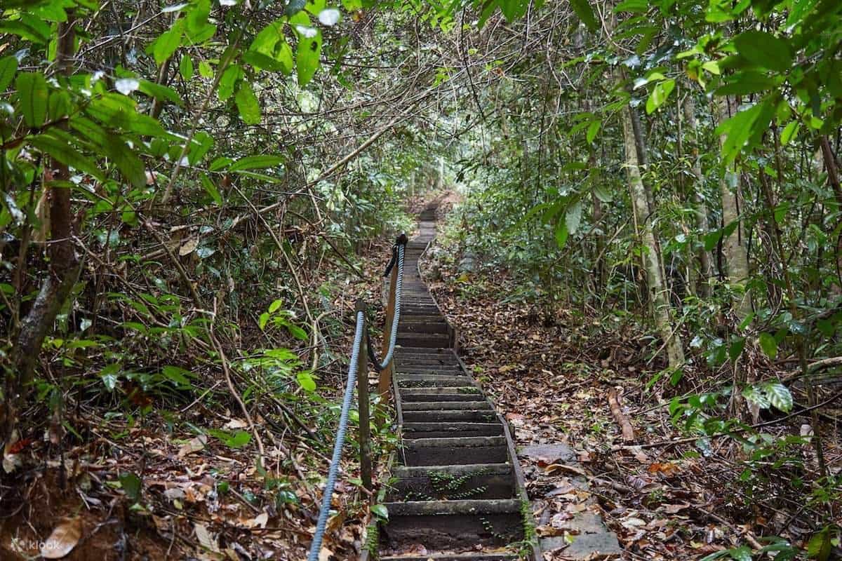
Trail Conditions: All trails pass through rainforest characterized by steep, rocky terrain that becomes increasingly muddy during rainy periods. Water crossings are occasional but manageable. Hikers should wear sturdy hiking boots with excellent grip, as slippery conditions pose genuine safety risks, particularly on the steeper summit sections.
Wildlife Encounters: Early morning hikes offer the highest probability of observing wildlife, particularly gibbons (recognizable by their haunting morning calls), macaques, hornbills, and occasional larger mammals. Reptiles including snakes and monitor lizards inhabit forest areas but typically avoid human contact when hikers remain on established trails.
Preparation Requirements: The moderate-to-challenging trails demand reasonable fitness levels, substantial water intake (2-3 liters minimum), energy-dense snacks, sun protection, insect repellent, and appropriate hiking footwear. Starting early (by 7:00-8:00 AM) provides cooler conditions, better wildlife viewing opportunities, and sufficient daylight for afternoon return without hurried pace.
Trail Combinations: Many experienced hikers pursue multiple-trail days by combining Waterfall 1, Waterfall 3, and the Summit Trail in single visits. The January 2024 visitor account described reaching all three waterfall locations and the summit within a single 5-hour, 15-minute adventure, demonstrating feasibility for fit, determined hikers with early starts and minimal rest time.
Historic Alternative Routes: The Lintang Trail at approximately 900 meters elevation provides access to the former Communist camp from the 1960s emergency period, though this route is less frequently traveled than major waterfall and summit trails.
Gunung Gading’s trail network accommodates everyone from families seeking 30-minute waterfall walks to experienced trekkers undertaking full-day summit expeditions, making it an exceptionally versatile jungle hiking destination within easily accessible distance of Kuching.